Gathering Public Sentiment2019

Planning and Zoning mobile application

Overview

It is important for cities and land developers to establish master plans around growth. This relationship pins those two roles against the general public as projects are developed. Land developers are the means to increase the tax base and allow the funding of improvements to municipal systems to address the growth and congestion they create.

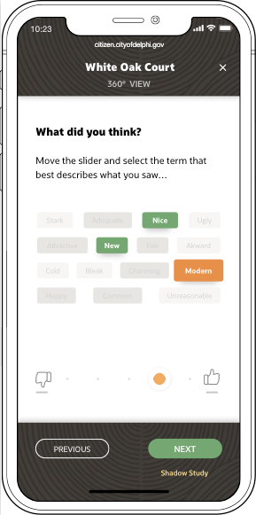
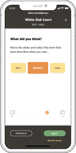
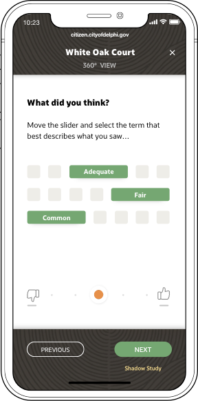
A key to keeping a growth plan on track is getting the greater communities buy-in, to stay on top of pain points and minimize impacts to property prices and quality of life. Gathering data around sentiment is becoming increasingly more important, there is a move towards using AI to better predict the success rates of projects based on such metrics.

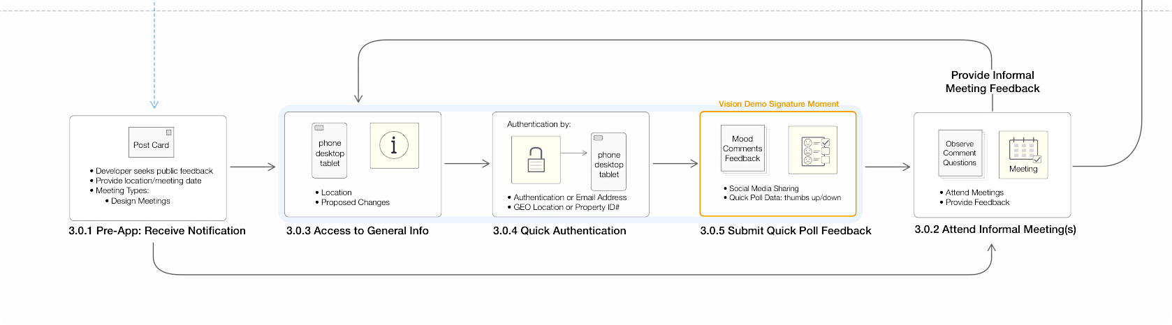
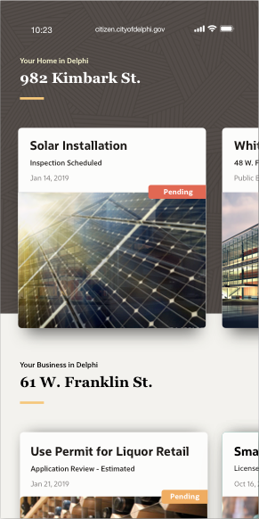
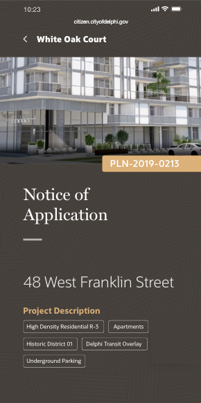
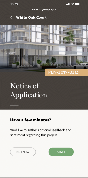
The objective of the Gather Public Sentiment project was to design a mobile flow that is driven by emerging technologies that will aid cities and land developers with gathering meaningful sentiment data from directly impacted residents.

The User's Perspective

Flow diagram detailing use case of gathering sentiment feedback from the general public.
 

During the Pre-Application phase, the General Public will need to be contacted and made aware of the proposed development project affecting their immediate neighborhood; whether blocking their view, worsening traffic patterns, or impacting the history of a building. It will not be uncommon for the General Public during this phase to be invited multiple times to informal meetings with the sole purpose of providing feedback as the Land Developer iteratively modifies the design to eliminate possible code violations or problem points.

General Public during the Pre-Application Phase
 

Requirements

  • • Runs on mobile and uses GIS location services.
  • • Provide detailed overview of proposed project.
  • • Create AR, VR renderings of the project using standard industry BIM files.
  • • Gather rating information along with specific descriptors per areas of feedback.
  • • Support open commenting and track social media traffic.
 

Design directions

The process involved working closely with Public Sector product managers and external Land Developers to:

  • • Iterate, define and validate a basic flow between the three product demo user persona's.
  • • Define data points, important KPI's required to feed AI and analytic engines.
  • • Iterate the wireframes and define all interactions.
  • • Scrutinize the script, reviewing all data used to keep it as realistic as possible.
  • • Create a keynote demo used to demonstrate behaviors and interactions. (below)

Keynote wireframe demo

Prototype exploring user flow, interaction, motion, and cutting edge AR and VR renderings.


Final designs

After a brief roadshow demoing the wireframe prototype, fielding questions and gathering feedback, we moved on to refining and working on full color designs.

  • • Worked with writers on the symantics of the bubble feedback terms.
  • • Refined some data points, dropped the feedback from 10 groups of 3 terms down to 5 sets of 3.
  • • Explored feedback designs scaleable w/ locatization, support longer words and/or short statements.
  • • Iterated the high fidelity designs and adjusted micro-interactions.
  • • Synched up with other product groups to start using similar UI patterns, navigation flow and interactions.
  • • Worked with components team to derive common sets of patterns and generated component specifications.

High Fidelity Explorations


My Involvement

Requirements Gathering
Research
Flow Diagrams
Concept Development
UX Design
POC with PM
Wireframing, Interaction Design, and Visual Design
Collaborated with Usability Engineers, and Visual Design Team

Project Timeframe and Tools

Feb-June 2019. All the wireframing and design work was done using Sketch. 3D renderings were created using SketchUp.